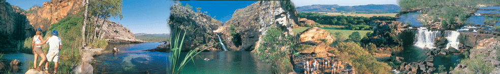
| Preface: I wrote
this blog after a recent 3 day photo shoot to Kakadu National
Park. When I searched the web I couldn't get a simple idea of
how the drive all feel into place. There probably are too many
phot'os on this page but I couldn't help myself. There are places
of interest here that will described in other pages soon in
greater detail such as the Mary River National Park - Ijust
have to go back down there for a separate trip soon. All the
web sites says just a 3 hour drive to Kakadu from Darwin and
only 253klm. If you don't blink and drive straight then that's
right but how could anyone drive straight and not stop.
Blog: Arnhem Highway from Darwin to Kakadu National Park
in Northern Territory Australia is 253klm.
Leaving Darwin is generally travelled on the Stuart Highway
from Darwin. Darwin CBD is basically 5 straight roads running
into Daly St which is around 2klm long and that runs and begins
the Stuart Highway. Map
of Darwin CBD. If you take the Stuart Highway it's around
22klm to the junction with the Stuart Highway veering left
to Katherine, Alice Springs, Kakadu and Litchfield and if
you keep straight the road goes to the smaller city of Palmerston
(Pop 22,000) straight ahead. Palmerston is also the home of
our Defense base.
Update: June 2011 - Forget the photo's below it's
all changed I just went down today from darwin and forgot
to take my camera. So let's say left to Kakadu and Katherine
and Alice Springs and straight ahead to Palmerston.
|
|
|
|
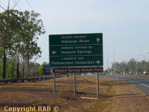
Then 3klm further the Howard Springs turnoff - which you
pass the turn off you actually don't drive thru this town.
There are a few bed and breakfasts and caravan parks in Howard
Springs.
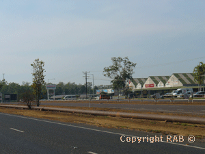
Veering left and further down 8klm you drive past the small
country township of Coolalinga conveniently located 26km south
of Darwin on the Stuart Highwa (last easy to find shopping
centre-Woolworths Supermarket).
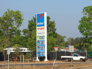
As you can see in Sept 2007 the fuel here at the Coolalinga
petrol station was Petrol AUD$1.32 per litre and Deisel was
AUD$1.26 per litre, a good spot to check your tyre pressure
and oil. |
|
|
|
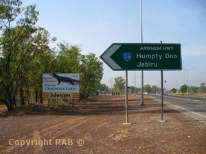
Down the highway around 35klm now from Darwin you see the
Arnhem Highway on the left with a sign saying Humpty Doo and
Jabiru. The first sight of interest alond the highway is the
didgeridoo workshop, actually at the beginning but it's on
the right of the road.
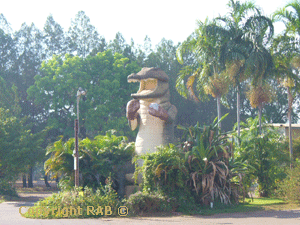
Humpty Doo, here is another fuel stop and the home to the
Boxing Crocodile though it a great photo snap for the kids
to be in it. It seems to be an obbession with Australian's
to have the biggest icon's. Humpty Doo is a large sprawling
country suburb of the outer Darwin region.
Point of Interest on humpty Doo: Humpty Doo is a
town some 10klm from the begiining of the Arnhem Highway with
around 2829 residents on 5-20 acre farms with some 1006 households
in the area. I mentioned this as Humpty Doo seemd to stretch
along the highway quiet a bit.
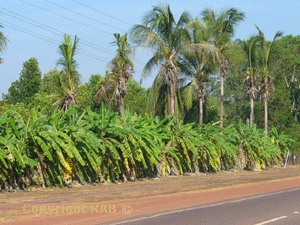
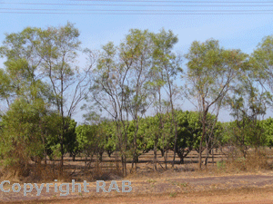
Futher out the properties are larger and mostly farmed as
Mango Plantations. Can you imagine the aroma driving with
the window down when there in season around October/November
(there was a small crop at the beginning of September also).
Oh Mango prices at the Darwin/Parap markets on a Saturday
morning are around $4-6 a kilo the first few weeks of the
season and in the middle of the season you get huge Bowan
Mangos (are you ready for this) I mean huge mangoes at AUD$2.50
a kilo.or whole trays at AUD$10.00 Just come for the mangoes
at least.
|
|
|
|
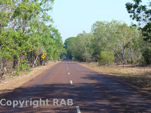
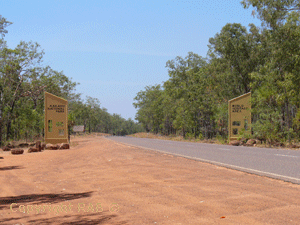
>The one things about the Arnhem Highway is once you are
on it you don't get lost. It has every sign you need.
>The sign are in a brown colour sometimes hard to see but
I was glad to see the blended into the background colours
of the land.
|
|
|
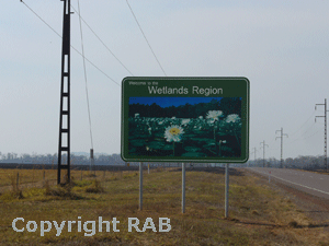
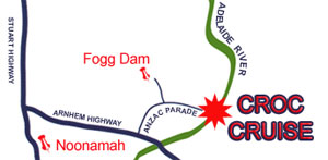
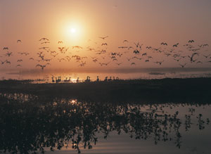
| >After we travelled further
along and sw signage for the Wetlands Region. Basically a low
lying land area that floods constantly during December to April
though is home to 1000's of migrating birds. In this area we
came to a a turnoff for Fogg Dam and as you can see from the
photo's it can be a day trip itself. Now a word of warning allow
3-5 hours here for 2 major icons. The first is Fogg Dam
Fogg Dam is the only wetland easily accessible to conventional
vehicles 12 months of the year – only an hour’s drive from
Darwin on a sealed road.
Turn onto the Arnhem Highway and drive 35km (22 miles) to
the Fogg Dam turnoff (Anzac Parade) on the left, which is
well signed, and drive 6km to the entrance on the left hand
side of the road, also well signed.
Large numbers of wading birds gather at the Dam wall at the
end of the wet season. From the end of March until the build
up, around the start of October is the best time to visit
Fogg Dam.
Woodlands to Waterlily - Length: 2.2 km return. Time: 45
minutes. Grade: easy.
Monsoon Forest Walk - Length: 3.6 km. Time: 2 hours. Grade:
easy.
Dam Wall Walk - Length: 2.2 km return. Time: 45 minutes. Grade:
easy.
Pandanus Lookout - Length: 2.5 km return. Time: 1 hour. Grade:
easy.
|
|
|
|
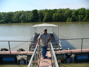
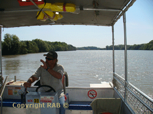
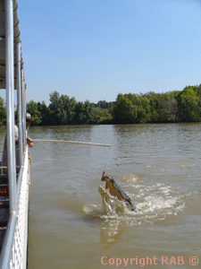
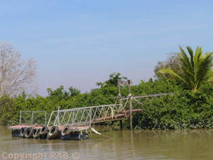
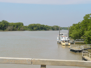
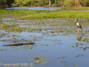
>The second is Harry Bowmans - Adelaide River Crocodile cruise.
So now we were some 6klm down the turnoff from the Arnhem
Highway and we had Fogg Dam but then if you continued on and
followed the hand made signs the road goes on for another
10 odd klms (or so it seemed) to a dead end. from there turn
right and the jumping crocodile cruise is located on their
private stretch of the Adelaide River at the end of Fogg Dam
Road. All in all it was about 75 minutes since I left Darwin.
I then followed to the right on a dirt track form some 5klm
to Harry Bowmans - Adelaide River Crocodile cruise. Once we
arrived I knew that the 40min trip was worth it. Harry and
Karen came out and greeted us large as life before he realised
he had known us from 10 years ago. So we received a special
once off private tour. And the photo's says it all. Wow that
30 minutes just amazed my wife and I. Harry's web site is
http://www.adelaiderivercruises.com.au/
Harry’s brother Morgan & wife Maxine joined him 10 years ago
when they embarked on a seachange from NSW. $43 for a adult
and $16 for a child with 4 cruises a day and the boat capivity
is 30 folks. Cruise times are 9am, 11am, 1pm, 3pm Daily from
May to November
|
|
|
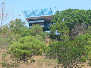
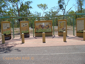
| We travelled back to the
Arnhem Highway and up the road about 10klm was the Windows to
the Wetlands. A great place to stop and view the birdlife from
a higher view and also really interesting display's inside to
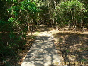
learn about the Wetlands. Diffinately worth stopping at. |
|
|
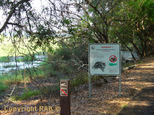
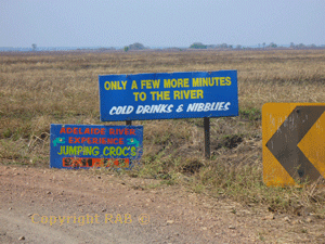
| >A few kilometres along the
Arnhem Highway and up the road to the Adelaide River about 3
klm were the other 2 Crocodile Cruises both larger business
ventures and a little easier to find. See below 2 photo's and
you will see what I mean. Window on the Wetlands Visitor Centre
is 62 klm from Darwin and Adelaide River Queen see below (Jumping
Crocodile Cruise) on the Adelaide River is 65 klm from Darwin. |
|
|
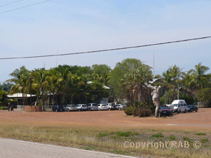
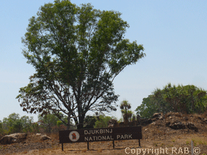
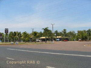
| >Along the Arnhem Highway
on the right is Corroboree Park Tavern - another place to stop
for fuel, drinks and a take away bit to eat. Djukbinj national
park along the Arnhem Highway forms part of the Marrakai floodplains,
Djukbinj National Park contains a portion of the catchment and
drainage for the Adelaide River in this area. The abundance
of water all year round has ensured the park's importance as
a roosting and feeding site for waterbirds, magpie geese, egrets
and brolgas. There is a carpark and bushwalking though I haven't
had time to fully explore it just yet. |
|
|
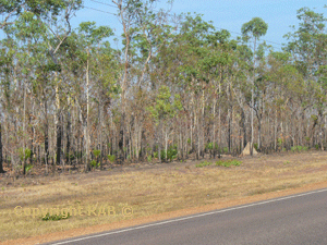
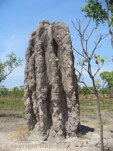
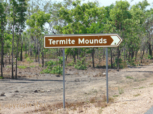
| Further along the highway
we came upon a unique sight and literally at our fingertips.
the Termite Mounds - they were actually on the roadside of the
Arnhem Highway. |
|
|
|
|
|
 |
|
|
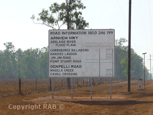
Here is a brief overlay on 3 turnoffs you pass before
coming into the Bark Hut Inn Roadhouse
Adventure Bound NT - a private business offering
corporate and schoold adventure and traing activities
http://www.basecampwallaroo.com/
.
|
|
|
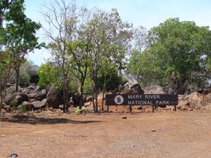
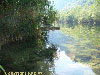
Mary River National Park - I actuallly intend to create
a new website just on this park a bit later. In the meantime
here is a good site. http://www.maryriverpark.com.au
and also http://www.pointstuart.com.au.
Bark Hut Tourism Centre which is located beside the Mary River
National Park reached via Point Stuart Road some 20 kilometres
on. In the park is the Mary River floodplain seen from Couzens
Lookout, or you can try fishing trips going to Shady Camp,
Rockhole or Corroboree Billabong. You can also hire a houseboat
on Corroboree Billabong from Mary River Houseboats.
|
|
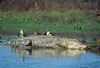
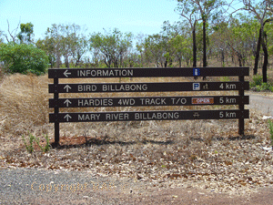
Hardies Track - The Hardies Track runs between the
Rockhole Road and the Arnhem Hwy and passes Bird Billabong
which has an abundance of bird and other wildlife. A small
bird hide is accessed by a app. 3 km return walk and offers
very good photographic opportunities. Allow approximately
3 hours for this drive and often closed int he wet season.
|
|
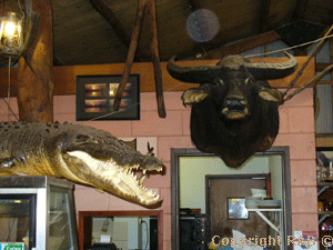
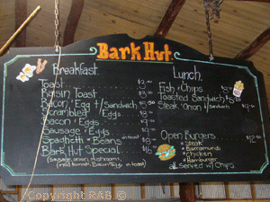
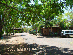
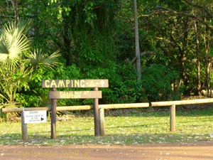
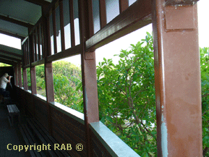
Bark Hut Inn & Caravan Park on Arnhem Hwy Kakadu National
Park NT 0886 Telephone: (08) 8978 8988 Facsimile: (08) 8978
8932. Here is a REAL Aussie Roadhouse with the walls adorned
by crocodiles and buffalo. This is a tourist icon in itself
and a must see on the way. The staff were a mix of international
backpackers and locals with the service friendly and meals
reasonable for a remote location. The park offers a nice pool
and campgrounds and basic budget donga's. There a good gift
shop and lot's of room to move around.
|
|
|
|
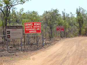
An alternative route to Cooinda (in Kakadu) is via turning
right off the Arnhem Highway onto the unsealed Old Jim Jim
Rd some 19km beyond the Bark Hut Inn (above). Often impassable
in the wet season October - April. Though more so with the
heavier rains January-March). The entrance to kakadu is around
38klm from the Bark Hut Inn. The gates are a great photographic
opportunity and also stop at the Kakadu Information centre
and there is a small box that has the free Kakadu Booklet
in it.
|
|
|
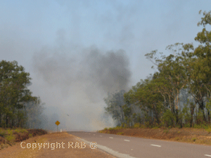
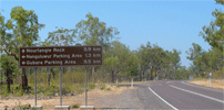
| 2
Mile Hole and 4 Mile Hole 4WD Track turnoffs are clearly
visable from the Arnhem Highway some way past the bark hut inn
roadhouse. In September you may witness an incredable sight
with the traditional burnoff (see the photo on the right below).
This is controlled burning for regrowth. It may be a bit hard
to see in this photo but there were around 30 kitty hawks circling
and diving on the smaller animals and reptiles escaping the
burnoff in the photo above. This is truely an amazing sight.
The road seemed very hazy to pass thru but really it was only
for a few metres nothing to worry about and then it was clear
again. |
|
|
|
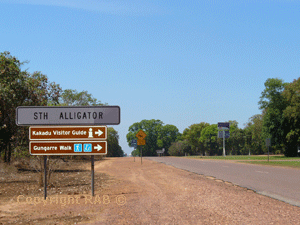
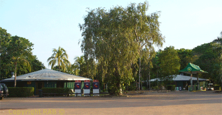
29klm pass the West Branch of the Aligator River you reach
the larger South Alligator river and also the Aurora Kakadu
South Alligator Resort with accommodation and camping facilties.
This where we filled up for fuel before driving down to Cooinda.
Just to be safe I would fill up here and check the road conditions.
|
|
|
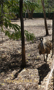
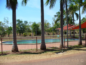
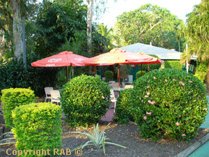
| Aurora Kakadu situated in
the Kakadu National Park is the perfect base to visit one of
the world's finest wildlife reserves. Set amidst 10 hectares
of lush bushland, Aurora Kakadu offers tropical gardens, manicured
lawns and abundant relaxation areas. Aurora Kakadu provides
guests with the opportunity to encounter close at hand some
of the Territory's spectacular wildlife. Magpie geese, Wallabies,
Corella and Goanna freely wander the landscaped gardens and
pool area. Guests are encouraged to explore further the natural
habitats of the animals and plants exhibited by experiencing
the park and it’s surrounds. Fact sheet Courtesy of https://www.auroraresorts.com.au/
|
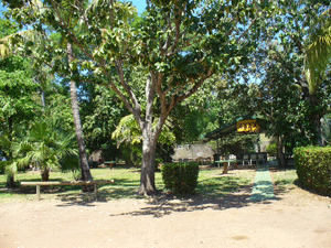
| Kakadu Resort (South Alligator)
- Aurora Kakadu - in the Kakadu Wetlands - Located
in the South Alligator Area of Kakadu, the Aurora
Kakadu is a 3 ˝ star property, offering 138 units
which include private patios or balconies, air
conditioning, colour television, refrigerator
and tea and coffee making facilities. |
 |
 |
|
|
|
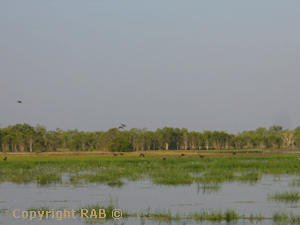
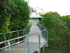
| From Aurora Kakadu South
Alligator Resort you are now about 40 klm to Jabiru and 7klm
to the Mamukala Wetlands. Now the Mamukala Wetlands Hatch is
not what i expected. Back in Darwin I had a very friendly lady
tell me that it was a fantastic hatch you crawled into. She
meant well but I don't think she had actually been too - see
what you think. |
|
|
SUMMARY: Blog on the road - Arnhem Highway to Kakadu
Well from here you are only 25klm to Jabiru and the end of
our stretch of the Arnhem Highway. Again all the web sites
says just a 3 hour drive to Kakadu from Darwin and only 253klm.
If you don't blink and drive straight then that's right but
how could anyone drive straight and not stop. I would say
stopping Fogg Dam, the Adelaide River Cruise, Bark Hut Inn,
the Termite Mounds, Windows to the Wetlands, Mamukala Wetlands,
South Alligator resort and stopping along the way say 10 times
for photo shoots is an absorbing 10-15 hours. Maybe do some
of the icons on the way back if you go back the same way.
Rob - September 2007
|
 |
|
General information on Kakadu National
Park
|
Roads to Kakadu National Park
 Road
conditions in the Park vary according to the two seasons being
the Green 'Wet' season or Dry season. Widespread Green 'Wet'
season flooding occured historically and frequently during
November to April there nowdays the seasons have changed signifciantly.
Therefore you should check the road conditions well before
your departure . Road
conditions in the Park vary according to the two seasons being
the Green 'Wet' season or Dry season. Widespread Green 'Wet'
season flooding occured historically and frequently during
November to April there nowdays the seasons have changed signifciantly.
Therefore you should check the road conditions well before
your departure .
Up-to-the-moment road reports can be obtained from the Bowali
Visitor Centre (Telephone +61 (0) 8 8938 1120). The Arnhem
and Kakadu Highways are sealed and generally remain open throughout
the year. Green 'Wet' season flooding associated with any
prolonged heavy rains may have various locational temporary
closures.
We here also provide helpful tips on Kakadu National Park
and what to see and activities available, visitor safety,
park camping and accommodation facilities, emergency contacts
and useful Kakadu Parks information.
If time allows, we advise you stay in the park for a 2-5
days so that the major sites can be explored at your leisure.
Kakadu National Park can be visited selfdrive a 2 wheel drive
vehicle such as a car, camper, 4WD or even a large motorhome
though access is limited to the Kakadu Highway and the Arnhem
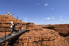
Highway. Ubirr, Yellow Waters, Jabiru and Nourlangie Rock
being main the extent of where you can visit a 2 wheel drive
vehicle. Currently about 200,000+ folks visit Kakadu National
Park each year. Visitor numbers are higher during the dry
season months of June to September (approx. 33,000 people
visit each July) and lower during the wet season months (approx.
7,000 people visit each January).
|
|
 Where
is Kakadu National Park Where
is Kakadu National Park
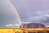
Kakadu National Park an Australian Natural Icon covers almost
20,000 square kms and is 257 kms East of Darwin the capital
city of the Northern Territory, Australia. Kakadu National
Park is a World Heritage listed area that has been listed
for it's cultural and natural heritage and Kakadu is the largest
terrestrial national park in Australia. Life in the park does
depends on the water, also in respect to the tropical monsoon
climate that produces the downpours of the tropical humidity
of the "wet" season, and the milder weather of the "dry" season.
Kakadu National Park is the gateway to Arnhemland. The sealed
roads from Darwin to Kakadu is via the Arnhem Highway and
from Katherine to Kakadu National Park via the Kakadu Highway.
The Bowali Visitor Centre near Jabiru in Kakadu National Park
is located 257 km from Darwin in Northern Territory Australia
via the Arnhem Highway entrance. If travelling by road, you
should allow 3 hours travelling time from Darwin. Maps
of the road to Kakadu National Park and of Kakadu National
Park.
|

|
Kakadu National Park - Seasons
But Australia's Kakadu sees seasons of varied extremes --
so varied, in fact, that the park's longtime aboriginal inhabitants
have divided the year into six distinct seasons.
• Kakadu
Seasons - Gunumeleng Pre-Monsoon Storm Season - Gunumeleng,
from mid-October to late December, may in fact last from a
few weeks to several months.
• Kakadu
Seasons - Gudjewg - Monsoon Season - Gudjewg, from January
to March, can be described as the 'true' wet season.
• Kakadu
Seasons - Banggereng - Knock 'em down storm Season - Banggerreng,
in April, is the season when the rain clouds have dispersed
and clear skies prevail.
• Kakadu
Seasons - Yegge - Cooler but still humid Season - Yegge,
from May to mid-June, is relatively cool with low humidity.
• Kakadu
Seasons - Wurrgeng - Cold Weather Season - Wurrgeng, from
mid-June to mid-August, is the 'cold weather' time; humidity
is low, daytime temperatures are around 30°C and night-time
temperatures are around 17°C.
• Kakadu
Seasons - Gurrung - Hot Dry Weather - Gurrung, from mid-August
to mid-October, is hot and dry.
|
|
|
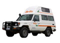
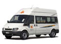
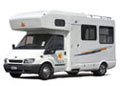
| 4WD Cars &
4WD Campers |
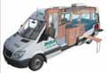
2WD Campers
& Motorhomes |
No Hidden
Costs |
• Take your adventure OFF-ROAD!
• The ultimate camping experience
• 4WD Campervans also available |
• Great holidays at affordable prices
• Spacious and feature rich!
• Perfect getaway for families & couples |
• All applicable fees and charges included
• Detailed price breakdown
• Know what you're paying for! |
|
|


 Click
here for manual old fashion customized quote
Click
here for manual old fashion customized quote
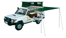
Example of a 4wd camper hire
Click
here email us your enquiry if your not sure
If you don't wish a instant quote and wish a manual customised
one then:
Please include this in your request for availability and quote.
 Full
Name Full
Name
Country
of residence
Main
Driver/Hirer Licence issued from which country
Number
of those travelling
Ages
of drivers
Ages
of children under 12 (child seat guidelines)
Telphone
No. + country code
Exact
start and Finish date and such as Darwin to Broome
Route
such as Gibb River Road
|
|
Adds by Australia 4 Wheel Drive Rentals
|
|
|
|
|
|
|
|
|
|
|
|
|
|
|
|
|
 www.kakadunationalparkaustralia.com
is part of the specialist for selfdrive leisure vehicle rentals
and tour specialist including camping and accommodated one
day or extended tours and safaris from the group of Goholi
groop being an experienced respected licensed Travel Agent
in Darwin, Northern Terriotry Australia (Tel +61 (0) 8 7999
7511). Why come to us - Let us try to get you a discount off
the recommended rates with professional and experienced service.
www.kakadunationalparkaustralia.com is an 'Affiliate'
of the Australia 4 Wheel Drive Rentals group of sites. A licensed
Australian Travel Agent based in Northern Territory Australia. www.kakadunationalparkaustralia.com
is part of the specialist for selfdrive leisure vehicle rentals
and tour specialist including camping and accommodated one
day or extended tours and safaris from the group of Goholi
groop being an experienced respected licensed Travel Agent
in Darwin, Northern Terriotry Australia (Tel +61 (0) 8 7999
7511). Why come to us - Let us try to get you a discount off
the recommended rates with professional and experienced service.
www.kakadunationalparkaustralia.com is an 'Affiliate'
of the Australia 4 Wheel Drive Rentals group of sites. A licensed
Australian Travel Agent based in Northern Territory Australia.
Goholi Pty Ltd
Postal: GPO Box 380, Darwin, NT 0801
Email: info@australia4wdrentals.com
www.kakadunationalaprkaustralia.com has affliation with the
following links
• http://www.australia4tours.com
• http://www.kakadu-tours.com
• http://www.australia4wheeldriverentals.com
• http://www.australia4wdrentals.com
•Home
• Contact
Us • Site
Disclaimer • Weather
Reports • Currency
Conversion • General
Links • Site
Map
Australian Tour Information - Mission Statement
Please note some of these links are supplied only as a link
for information our company has no affliation some of these
links. Important;
This site is for the beneift of those researching for their
next vacation to Kakadu National Park in Northern Territory
Australia also know as the 'Top End'.
Australian Kakadu National Park travel guide and information
is not the offical site - the offical government site is http://www.kakadu.com.au.
This search site offering links to Kakadu, Litchfield, Uluru,
Darwin and Northern Territory accommodations, tours, safaris,
activities, nature parks, nature reserves and adventure activities.
|
|
|